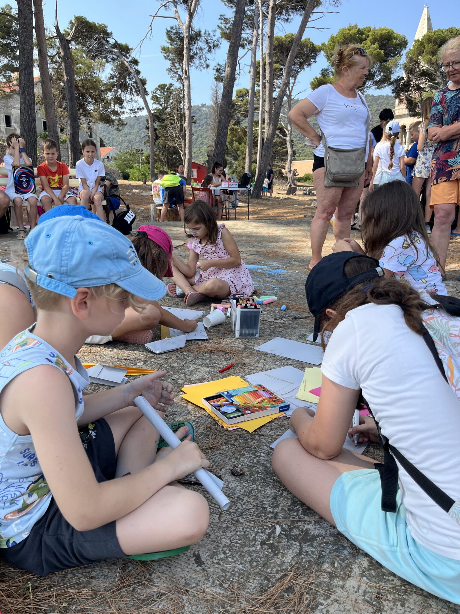
We celebrated the 34th Dolphin Day!
On Wednesday, July 1st, we marked our traditional Dolphin Day....
13.09.2016

Marine Spatial Planning (MSP) of the Adriatic Sea is becoming more essential as competition for space continues to expand. Different users seek to use the marine environment in different ways. Traditional uses, such as shipping, fishing and protected areas, are being challenged by new uses, such as oil and gas exploration and exploitation and coastal and nautical tourism. Some of these uses can be made compatible with cooperation and compromise, for instance tourism and protected areas can be compatible with considerations of the carrying capacity of the regions. However, fishery and oil and gas explotation are rarely compatible due to their requirements to physically alter the environment. MSP provides a logical system to allow each user understand the limits of not only their use but the use of others. Marxan provides a systamtic scientific based framework through which a well-managed spatial plan can develop, reducing conflicts, providing clarity to effectively use marine space.
Between the 4th and the 9th of September 2016 the Blue World Institute organised and hosted an international workshop looking at the role of the Decision Support Tool ‘Marxan’ in multi-objective Marine Spatial Planning in the Adriatic.
This five-day capacity building course was developed to assist practitioners to determine the feasibility of planning for multiple objectives in the Adriatic Sea based on available data and with support from Marxan software.
The first two days of the workshop provided a high-level background on marine systematic conservation and sea use planning, and cover the questions of when, where, and why to use Marxan and other decision support tools. Also, essential elements of successful planning processes were highlighted and explained and further explained through case studies of initiatives around the world. In addition, the discussion around how to integrate the knowledge from ADRIATIC+ projects and ADRIPLAN, identify data gaps and overlaps, and determine the feasibility of using a Decision Support Tool for the Adriatic was initiated.
The goal of the last three days of the workshop was to provide technical knowledge and skills necessary to use Marxan and Marxan with Zones in the context of marine conservation and human use planning. For this portion of the workshop participants were required to have at least intermediate knowledge of GIS and GIS tools (ArcGIS or QuantumGIS). Participants were also required to bring their own laptops with the required software already installed for the technical training (instructions will be provided ahead of time of the necessary software).
The workshop was led by Norma Serra-Sogas (PacMARA, Canada) and Jennifer McGowan (Unviersity of Queensland, Australia). The workshop was attended by experts from Italy, Spain, Montenegro, Slovenia and Croatia.
This workshop is undertaken as part of the Adriatic Plus project co-funded by the EU IPA Adriatic CBC programme and combines data taken from 5 previous projects funded in the same programme.
Project is co-financed by the Croatian Government Office for Cooperation with NGOs. The views expressed in this program are the sole responsibility of Blue World Institute.
On Wednesday, July 1st, we marked our traditional Dolphin Day....

Over the past few weeks, we have reviewed numerous photographs...
On 15 May, the Blue World Institute marked Posidonia Day...
Yesterday a blue shark (Prionace glauca) was seen in the...
